Fichier:Connecticut Presidential Election Results 2016.svg

Taille de cet aperçu PNG pour ce fichier SVG : 156 × 127 pixels. Autres résolutions : 295 × 240 pixels | 590 × 480 pixels | 943 × 768 pixels | 1 258 × 1 024 pixels | 2 516 × 2 048 pixels.
Fichier d’origine (Fichier SVG, nominalement de 156 × 127 pixels, taille : 5 kio)
Ce fichier provient de Wikimedia Commons.
Les informations le concernant sont affichées dans cette page de description qui est copiée ci-dessous.
Commons est un serveur de fichiers sous licence libre. Vous pouvez aider (procédure). |

Description
| Description |
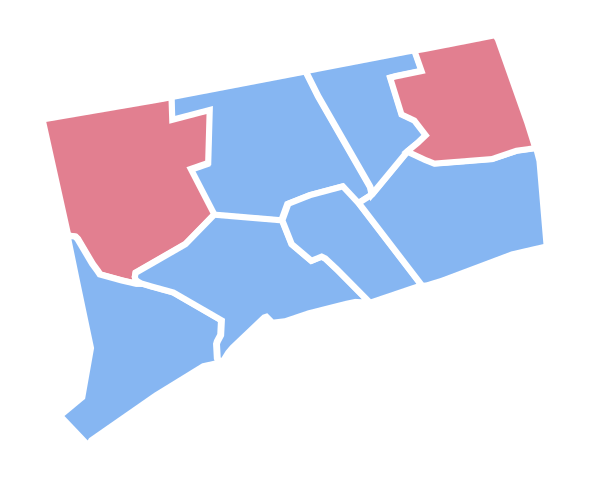
English: Connecticut Presidential Election Results 2016 |
| Date | |
| Source | Travail personnel |
| Auteur | Ali Zifan |
Conditions d’utilisation
Moi, en tant que détenteur des droits d’auteur sur cette œuvre, je la publie sous la licence suivante :
Ce fichier est sous la licence Creative Commons Attribution – Partage dans les Mêmes Conditions 4.0 International.
- Vous êtes libre :
- de partager – de copier, distribuer et transmettre cette œuvre
- d’adapter – de modifier cette œuvre
- Sous les conditions suivantes :
- paternité – Vous devez donner les informations appropriées concernant l'auteur, fournir un lien vers la licence et indiquer si des modifications ont été faites. Vous pouvez faire cela par tout moyen raisonnable, mais en aucune façon suggérant que l’auteur vous soutient ou approuve l’utilisation que vous en faites.
- partage à l’identique – Si vous modifiez, transformez, ou vous basez sur cette œuvre, vous devez distribuer votre contribution sous la même licence ou une licence compatible avec celle de l’original.
Historique du fichier
Cliquer sur une date et heure pour voir le fichier tel qu'il était à ce moment-là.
| Date et heure | Vignette | Dimensions | Utilisateur | Commentaire | |
|---|---|---|---|---|---|
| actuel | 20 février 2017 à 22:08 | | 156 × 127 (5 kio) | PalmerTheGolfer | Reverted to version as of 21:01, 15 January 2017 (UTC) I'm just saying, there is no need for idiosyncratic county lines to be included while this map is : Not inaccurate, conforms to previous maps. |
| 20 février 2017 à 22:08 |  | 156 × 127 (5 kio) | PalmerTheGolfer | Reverted to version as of 21:01, 15 January 2017 (UTC) I'm just saying, there is no need for idiosyncratic county lines to be included while this map is : Not inaccurate, conforms to previous maps. | |
| 16 janvier 2017 à 01:31 |  | 156 × 127 (9 kio) | Kingofthedead | Yes, however, there is no reason for consistency when this map form outlines the state more accurately than the previous one. | |
| 15 janvier 2017 à 21:01 |  | 156 × 127 (5 kio) | PalmerTheGolfer | Reverted to version as of 23:20, 9 November 2016 (UTC) While the current map may describe the idiosyncrasies of CT's counties more accurately, the form of the map does not conform to previous map forms, such as lining, as plenty of other states do not... | |
| 28 décembre 2016 à 19:37 |  | 156 × 127 (9 kio) | Kingofthedead | Reverted to version as of 05:52, 23 December 2016 (UTC) This map is not "tough to see" and is far more accurate. | |
| 27 décembre 2016 à 02:42 |  | 156 × 127 (6 kio) | PalmerTheGolfer | Reverted to version as of 03:24, 22 December 2016 (UTC) Why have a more rigid, tough to see map? | |
| 23 décembre 2016 à 05:52 |  | 156 × 127 (9 kio) | Kingofthedead | Reverted to version as of 18:43, 18 December 2016 (UTC) | |
| 22 décembre 2016 à 03:24 |  | 156 × 127 (6 kio) | PalmerTheGolfer | Reverted to version as of 19:12, 17 December 2016 (UTC) No need to make State more rigid, as previous elections have different maps | |
| 18 décembre 2016 à 18:43 |  | 156 × 127 (9 kio) | WikiBunny2K1 | Update shape | |
| 17 décembre 2016 à 19:12 |  | 156 × 127 (6 kio) | WikiBunny2K1 | Rotate |
Utilisation du fichier
La page suivante utilise ce fichier :
Usage global du fichier
Les autres wikis suivants utilisent ce fichier :
- Utilisation sur pt.wikinews.org
- Utilisation sur simple.wikipedia.org