Fichier:Port-Au-Prince and Carrefour map.png
Taille de cet aperçu : 800 × 462 pixels. Autres résolutions : 320 × 185 pixels | 640 × 370 pixels | 848 × 490 pixels.
Fichier d’origine (848 × 490 pixels, taille du fichier : 197 kio, type MIME : image/png)
Ce fichier provient de Wikimedia Commons.
Les informations le concernant sont affichées dans cette page de description qui est copiée ci-dessous.
Commons est un serveur de fichiers sous licence libre. Vous pouvez aider (procédure). |

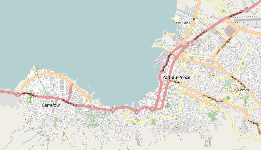
| Description | Map of Port-Au-Prince and Carrefour in Haiti |
| Date | |
| Source | openstreetmap.org |
| Auteur | Collaboratively created by the OpenStreetMap community using only free map sources and manual GPS surveying to build the map from scratch. In this particular case special access to DigitalGlobe and GeoEye aerial imagery was granted to the OpenStreetMap project, and was used to enhance the detail in this map. |
| Autorisation (Réutilisation de ce fichier) |
Ce fichier est disponible selon les termes de la licence Creative Commons Attribution – Partage dans les Mêmes Conditions 2.0 Générique
|
| Autres versions | The 'live' version of this map is available at http://www.openstreetmap.org/?lat=18.5456&lon=-72.3526&zoom=13 With the usual facility to zoom in for more details. You can also use the 'export' tab to get a fresh export in a variety of formats. This includes SVG, although a map of this size will generally be too complex to export (or work with) to this format. '.osm' format is the underlying geolocated data. Use the 'edit' tab on OpenStreetMap's website to edit the map. |
Historique du fichier
Cliquer sur une date et heure pour voir le fichier tel qu'il était à ce moment-là.
| Date et heure | Vignette | Dimensions | Utilisateur | Commentaire | |
|---|---|---|---|---|---|
| actuel | 15 janvier 2010 à 14:26 | | 848 × 490 (197 kio) | Harry Wood | {{Information |Description=Map of Port-Au-Prince and Carrefour in Haiti |Source=[http://openstreetmap.org openstreetmap.org] |Date=2009-10-28 |Author=Collaboratively created by the OpenStreetMap community using only free map sources and manual GPS surveyi |
Utilisation du fichier
Les 2 pages suivantes utilisent ce fichier :
Usage global du fichier
Les autres wikis suivants utilisent ce fichier :
- Utilisation sur azb.wikipedia.org
- Utilisation sur en.wikipedia.org
- Utilisation sur en.wikinews.org
- Utilisation sur fa.wikipedia.org
- Utilisation sur pl.wikipedia.org
- Utilisation sur pt.wikipedia.org
- Utilisation sur vi.wikipedia.org