Fichier:Sri Lanka carte.png
Pas de plus haute résolution disponible.
Sri_Lanka_carte.png (330 × 355 pixels, taille du fichier : 28 kio, type MIME : image/png)
Ce fichier provient de Wikimedia Commons.
Les informations le concernant sont affichées dans cette page de description qui est copiée ci-dessous.
Commons est un serveur de fichiers sous licence libre. Vous pouvez aider (procédure). |

Description
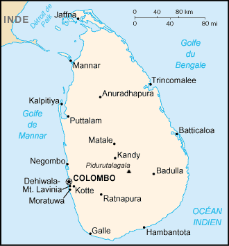
| Description |
English: Map in French of Sri Lanka Français : Carte en français du Sri Lanka |
| Date | |
| Source | CIA World Factbook |
| Auteur | Eric Gaba (fr:Sting) |
| Autres versions |
[]
|


.png)


Conditions d’utilisation
Cette image est dans le domaine public parce que son contenu provient du World Factbook, édité par la Central Intelligence Agency des États-Unis d’Amérique.
|
 |
| This work was previously under Public Domain, or a Free License. It has been digitally enhanced and/or modified. This derivative work has been (or is hereby) released into the public domain by its author, Sting at the French Wikipedia project. This applies worldwide. In some countries this is not legally possible; if so:
|
Historique du fichier
Cliquer sur une date et heure pour voir le fichier tel qu'il était à ce moment-là.
| Date et heure | Vignette | Dimensions | Utilisateur | Commentaire | |
|---|---|---|---|---|---|
| actuel | 30 août 2006 à 23:48 | | 330 × 355 (28 kio) | Sting | {{Information |Description=Map in French of Sri Lanka |Source=[https://www.cia.gov/cia/publications/factbook/index.html CIA World Factbook] |Date=translation : August 2006 |Author=of the translation : Eric Gaba (Sting) |Permission=PD |other |
Utilisation du fichier
Les 2 pages suivantes utilisent ce fichier :
Usage global du fichier
Les autres wikis suivants utilisent ce fichier :
- Utilisation sur ban.wikipedia.org
- Utilisation sur fr.wikipedia.org
- Utilisation sur mg.wikipedia.org
- Utilisation sur oc.wikipedia.org